Description
SIX (6) PROPERTIES SELLING IN ONE LOT:
REGISTRATION SECTION – SAN PEDRO; BLOCK – 7; PARCEL – 1355
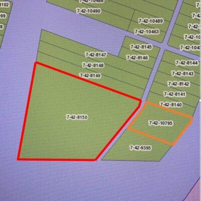
On the North by a road reserve; On the South by a gravelled road; On the East by Parcel No. 7-42-1354; On the West by Parcel No. 7-42-1356; Being Parcel No. 7-42-1355 containing 0.1237 of an acre (or 598.70 square yards) as shown on the land register of Parcel No. 7-42-1355 and on the Registry Index Map (RIM) of the San Pedro Registration Section lodged at the office of the Registrar of Lands in Belmopan.
REGISTRATION SECTION – SAN PEDRO; BLOCK – 7; PARCEL – 1356
On the North by a road reserve; On the South by a gravelled road; On the East by Parcel No. 7-42-1355; On the West by Parcel No. 7-42-1357; Being Parcel No. 7-42-1356 containing 0.1236 of an acre (or 598.40 square yards) as shown on the land register of Parcel No. 7-42-1356 and on the Registry Index Map (RIM) of the San Pedro Registration Section.
REGISTRATION SECTION – SAN PEDRO; BLOCK – 7; PARCEL – 1357
On the North by a road reserve; On the South by a gravelled road; On the East by Parcel No. 7-42-1356; On the West by Parcel No. 7-42-1358; Being Parcel No. 7-42-1357 containing 0.1342 of an acre (or 627.00 square yards) as shown on the land register of Parcel No. 7-42-1357 and on the Registry Index Map (RIM) of the San Pedro Registration Section.
REGISTRATION SECTION – SAN PEDRO; BLOCK – 7; PARCEL – 1358
On the North by a road reserve; On the South by a gravelled road; On the East by Parcel No. 7-42-1357; On the West by Parcel No. 7-42-1359; Being Parcel No. 7-42-1358 containing 0.1435 of an acre (or 684.40 square yards) as shown on the land register of Parcel No. 7-42-1358 and on the Registry Index Map (RIM) of the San Pedro Registration Section.
REGISTRATION SECTION – SAN PEDRO; BLOCK – 7; PARCEL – 1359
On the North by a road reserve; On the South by the sea; On the East by Parcels Nos. 7-42-1358, 7-42-1360 and the end of the gravelled public roadway; On the West by Parcel No. 7-42-1797; Being Parcel No. 7-42-1359 containing 4.100 acres as shown on the land register of Parcel No. 7-42-1359 and on the Registry Index Map (RIM) of the San Pedro Registration Section lodged at the office of the Registrar of Lands in Belmopan.
REGISTRATION SECTION – SAN PEDRO; BLOCK – 7; PARCEL – 1797
On the North by a road reserve; On the South by the sea; On the East by Parcel No. 7-42-1359; On the West by the sea; Being Parcel No. 7-42-1797 containing 1.100 acres as shown on the land register of Parcel No. 7-42-1797 and on the Registry Index Map (RIM) of the San Pedro Registration Section.
GENERAL PARTICULARS:
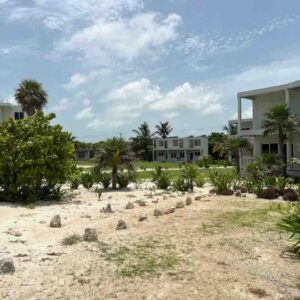
The parcels of land are located at the southern end of Ambergris Caye. The estimated distance from the Tropic Air Terminal in central San Pedro Town to the site of the lots is approximately 8.6 kilometers. Of this distance, approximately 3 kilometers is paved and the remaining 5.6 kilometers is a graveled surfaced roadway. The unpaved section of the road is in very good condition. Land use in the general area of the subjects is of a mixed residential and commercial nature. The commercial properties are mostly hotel developments. Electricity supply is available to the property site. Public water supply is approximately 2.7 kilometers east of the premises. The south end of the Island has become significantly more accessible due to the recent enhancements to the roadways in the area.
IMPROVEMENTS : PARCEL NO. 1359.
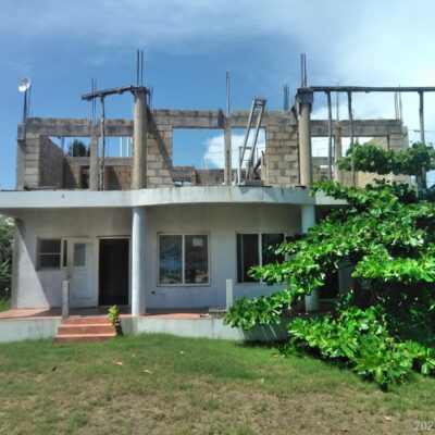
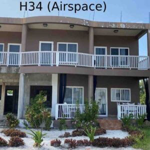
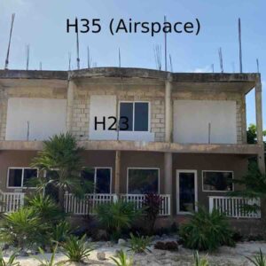
At the entrance to Parcel No. 7-42-1359 is an office building. The office building is located at the outside corner of Parcel No. 7-42-1358. The building has overall external dimensions of approximately 25 feet by approximately 30 feet, inclusive of an entrance porch approximately 9 feet by 12 feet. The office building was locked and viewing of the inside was not possible. The external walls of the building are masonry block walls and the external sides are covered with external wall tiles. The windows are fixed glass windows and the entrance door is a mahogany door with a clear glass panel. The floor is tiled. The building appears to be in very good condition There are three – five storied concrete buildings on the southern side Parcel No. 7-42-1359. The three building are all of similar dimensions, designs, and layouts. The external dimensions of the buildings are approximately 70 feet by 100 feet. Under the ground floors of the buildings are plumbing, electrical and water maintenance basements. The basements appear to be about 6 – 7 feet below the ground floor level. The rooftops of the buildings have swimming pools with what appears to be concrete decks in front of the swimming pools. The enclosed structures on the rooftops appear to be changing and shower rooms, and restrooms. The ground floors have three residential units on the side of the buildings facing the sea. The opposite sides of the buildings accommodate two residential units at the ends of the buildings. The spaces between these two units accommodate internal concrete staircases and elevator shafts. The internal staircases and the elevator shafts are designed from the ground floor level to the rooftop. The two units at the ends of the buildings measure approximately 30 feet by a depth of approximately 27 feet with front porches of approximately 10 feet by 28 feet. The middle units have dimensions of approximately 40 feet by 25 feet with oval shaped front porches. The back units each measure approximately 35 feet by 26 feet. There is an aisle the entire width of the building. The internal stairwells and the elevator shaft spaces measure approximately 20 feet by 25 feet from ground floor to the rooftop. The internal layouts of the first, second, third and fourth levels of the buildings are similar to the ground floor layouts. The following are details of the buildings:-
- BUILDING FRAMES AND FOUNDATIONS :
- The buildings are constructed on reinforced concrete piles and the building frames are steel building frames. The skeleton frames are of vertical steel columns and horizontal I-beams. The steel frames support the building floors, roofs, and walls. The columns and beams are encased with concrete.
- WALLS : The walls are of covintec panels. Most of the building walls have been rendered with cement and sand.
- FLOORS : Concrete.
- ROOF : Concrete. The rooftops have swimming pools with changing rooms, shower, and restrooms.
There is evidence that primary plumbing works have been carried out. PVC conduits for electrical works were also observed in sections of the buildings. The property boundary between the southeastern corner of the subject and of Parcel No. 7-42-1360 has a masonry block wall. The fence is in very good condition.
PARCEL NO. 1797.
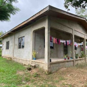
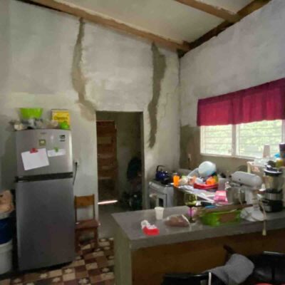
There are two similar buildings on Parcel No. 7-42-1797. These two buildings are along the western boundary of the lot with frontage to the sea. The building sizes are the same as those on Parcel No. 7-42-1359. The layouts are similar and the type of construction and the building materials are similar. Sections of internal covintec walls of the building at the northwestern corner of the lot are only partially covered with concrete. Attached are photographs of the improvements on the lots.
(Being an incomplete resort development TOGETHER with SIX (6) parcels of land [1355 -598.70 S.Y., 1356 – 598.40 SY, 1357 – 627.00 SY, 1358 – 684.40 SY, 1359 – 4.1 Acres AND 1797 – 1.1 Acres] situate at Boca Chica, Southern End of San Pedro on Ambergris Caye, the freehold properties of Messrs. Boca Chica Resorts Limited)
GOOGLE LINK:
https://maps.app.goo.gl/cRRihNDzj6osmYBj8
NB – SALE IS CONDUCTED IN BELIZE DOLLARS
